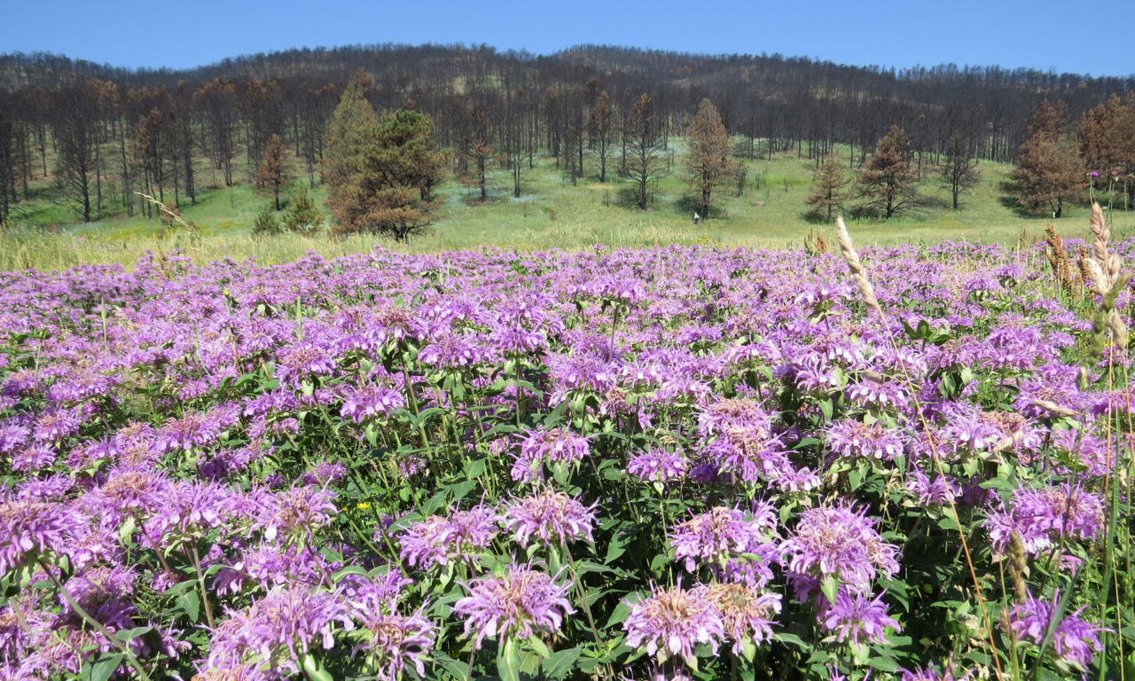
If you’ve visited Heil Valley Ranch Open Space in the past, you may be one of the many hikers, mountain bikers, bird-watchers, and general nature lovers who appreciate this special place and wonder what it looks like after the Cal-Wood Fire.
You may also be one of the visitors to the property who have noticed ongoing forestry projects to thin overgrown forests. Historically, our ponderosa pine forests were less dense than they are today; however, as fire suppression, clear cutting, mining, and cattle grazing became common in the mid-1800s, ponderosa pine forests grew denser and fire prone. Starting in the late 1990s, Boulder County Parks & Open Space (BCPOS) began forest thinning projects to improve the health of our ponderosa pine forests, help prevent fire, and reduce the severity of fires that do happen. Although these projects may have helped, they certainly did not stop last year’s Cal-Wood Fire.
The 2020 Cal-Wood Fire was the largest in Boulder County’s history, affecting more than 4,000 acres of Heil Valley Ranch and damaging the southern half of the park so severely that it is currently closed to visitors.
The fire burned infrastructure such as bridges and created the conditions for flash flooding. In areas where the fire burned extremely hot, the soil is now hydrophobic, meaning it repels water. With no vegetation to absorb and slow water, even short thunderstorms can cause dangerous debris flows. Fire recovery work includes hazardous tree removal, aerial mulching, erosion mitigation, and replacing damaged visitor amenities and park infrastructure, including bridges, fencing, parking stops, and signs.
Volunteering to “Follow the Fire”
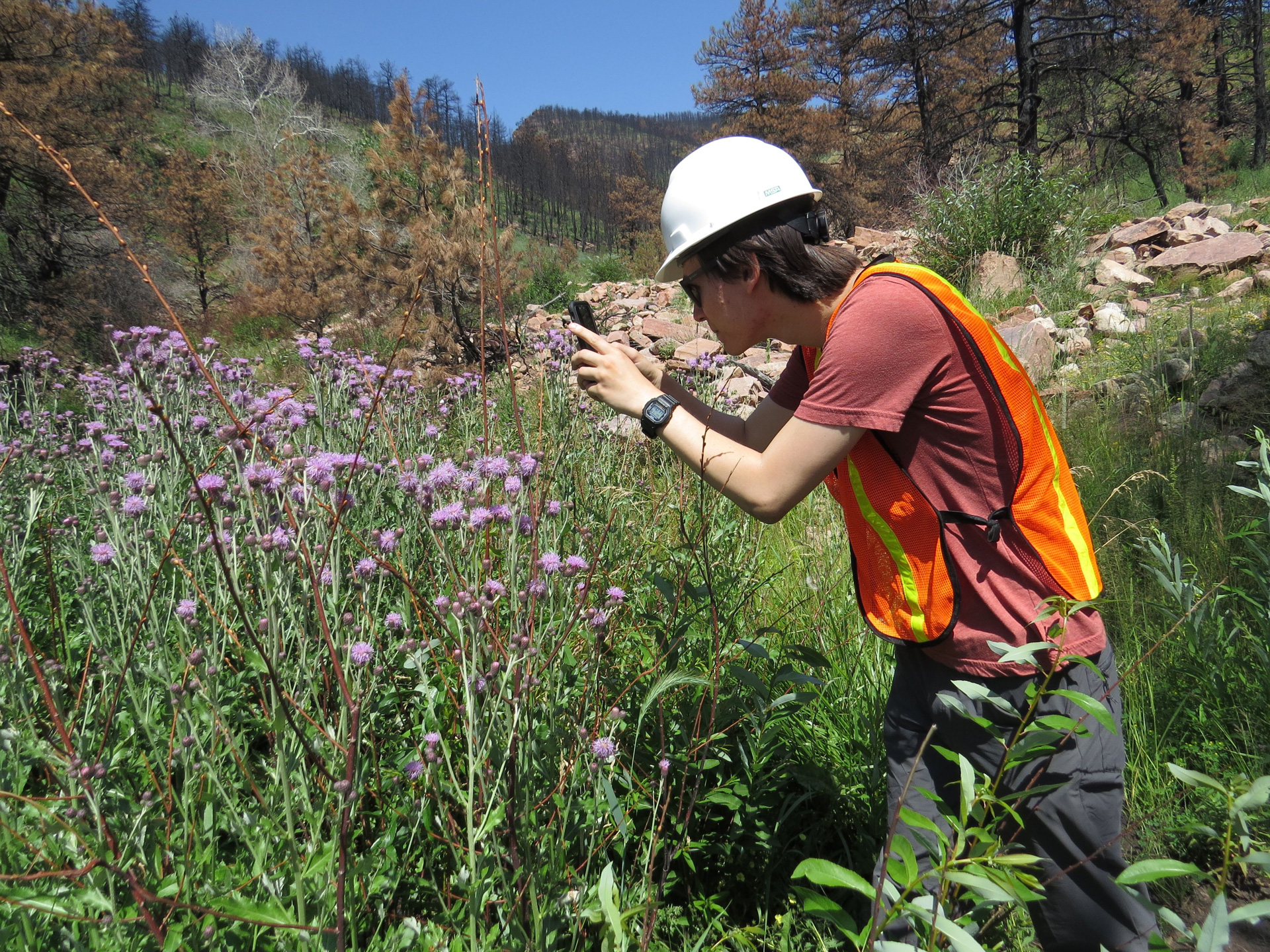
Though the area is not open to the public, volunteers outfitted with high-visibility vests and helmets have been able to enter the park as “fire followers” in partnership with BCPOS, Lefthand Watershed Center, and the Cal-Wood Education Center. Volunteers use the “iNaturalist” app (free to download) to document the plants that are re-emerging in the burn area so that we can better understand the fire recovery process. Volunteers don’t have to be plant experts, they just need to be able to upload a picture, location, and a suggestion of the plant-type if not sure of the name. Experts on iNaturalist will assist with correctly identifying the plant. If you’re interested in participating in a future Fire Followers event, you can sign up at boco.org/volunteer.
Beyond allowing groups of volunteers into the burned area, the county has also been working to ensure the property is safe for visitors and will recover well from the fire. One technique that addresses both of these goals has been removing dead trees in high-traffic areas; these trees are removed by helicopter and turned into mulch. Another helicopter then lifts a load of mulch and distributes it over heavily burned areas. This mulch covers the soil and absorbs precipitation, helping with plant restoration and reducing the risk of flash flooding. The county is also working on replacing damaged and destroyed infrastructure, including rebuilding trails that have been covered in sediment.
The Picture Rock trailhead at the north end of the park remains open, and evidence of the fire can be seen along some stretches. To learn more about the restoration work going on at Heil Valley Ranch, visit boco.org/heilrecovery.