Parks and Open Space has been sharing information with Boulder County residents since the department was formed in 1975. We try to provide many different types of information through various publications and online sites. Our goal is to provide useful information in a format that residents can easily access.
During the past decade, communications technology has changed dramatically. The department has experimented with some of these new tools to reach out to residents (for example, Facebook and Twitter), but we weren’t sure how that was working. What we really wanted was to have relevant and consistent information throughout the open space program that park visitors recognize and appreciate, and rules and regulations posted clearly to help to increase compliance.
We decided to get help from an outside marketing firm to ask Boulder County residents what they thought. Are we giving them information in a format they can use and in a location that’s easy to find?
Communications Study Goal
To enhance the general public’s knowledge, understanding, and appreciation of open space properties and the rules and regulations through better communication and consistency of communications tools.
Objectives
- Evaluate public communication tools for providing relevant, desired, and necessary information
- Identify specific terminology for area closures to increase understanding, appreciation, and compliance
- Develop consistent standards for branding and messaging across all communication tools
Methodology
- Five focus groups
- 436 surveys at five popular properties
- Professional review of communications materials
- Literature review of current best practices
Key Findings: What Did People Tell Us?
- Park users primarily go to the website and trail signs for information about most topics
- People are generally very satisfied with communications from Parks & Open Space
- To a large extent, the experience at the property matches the information provided about the park or trail
Top Information People Want to See
- Trail map
- Plants, wildlife, and sights to see at the property
- Trail length and difficulty level
- Allowed property and trail uses
- Information they want to see on closure signs is the reason the area is closed and a map of the closed area.
So We Listened!
You may have noticed this issue of Images has a new look, and the brochures and kiosks have also received a facelift! Here are some of the changes:
Images Magazine
- Updated contemporary design
- More photos and graphics
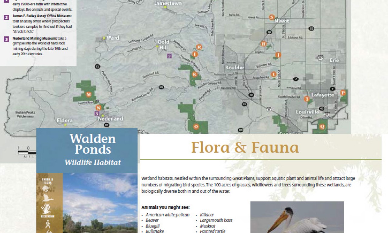
Maps
- Updated four-color design
- Photos of must-see destinations
- Clear distinction of open recreation areas and closed areas with the closure type/reason clearly stated
- New trail elevation graphs showing trail difficulty
- Trails more prominent in vivid white
Property Brochures
- New colorful design
- New map is bigger
- Higher quality photos
- Highlights: common plants & wildlife, and views or structures that shouldn’t be missed
- Icons for the rules and regulations for at-a-glance reading
Park Kiosks
- Bigger map is prominently featured
- Icons for the rules and regulations for at-a-glance reading