From hiking Boulder County’s trails and open space, to picnicking in one of the many parks in the area, to exploring the history of Boulder or its surrounding mining towns, there is certainly no shortage of outdoor activities in our county. Did you know that there’s a great local resource to make your outdoor explorations even more interesting, enlightening and entertaining?
Visit the University of Colorado Boulder’s Jerry Crail Johnson Earth Sciences & Map Library in the Benson Earth Sciences building on CU’s campus, and you will come away with many new ideas for your adventures in and around our region. Here you will find books on a variety of topics, such as geology, hydrology, paleontology and environmental studies. You can browse a copy of Geology Underfoot along Colorado’s Front Range by Lon Abbott and Terri Cook, or learn about Nederland’s beginnings by reading Nederland: a Trip to Cloudland by Isabel M. Becker.
Maps200,000 & Counting
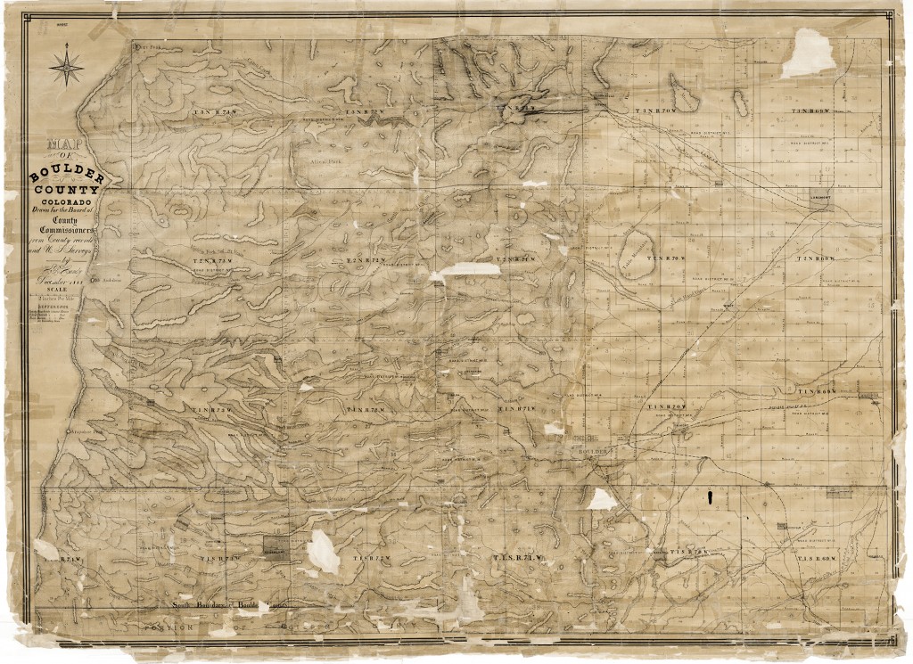
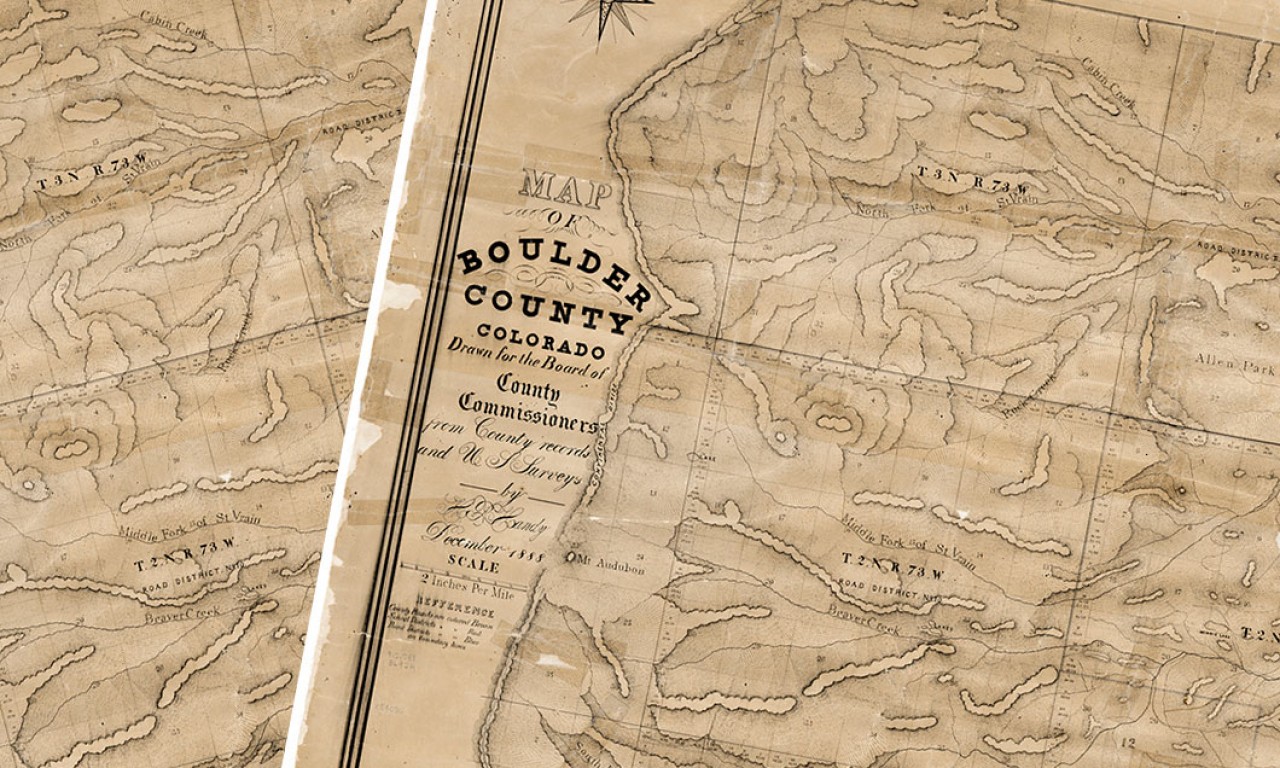
But there’s still more to discover in the library. The Map Library is home to over 200,000 maps and over 1,000 atlases and reference books. You can find a lot of new and exciting information about Boulder County by taking a few minutes to look around.
There are National Geographic Trails Illustrated maps for all sorts of Colorado hiking areas, including trails in Boulder, Indian Peaks, and Gold Hill just to name a few. The library also collects trail maps from private publishers such as Latitude 40 and Sky Terrain. You can check out our maps if you have a CU library card or copy and scan the sections of the map you’ll need for your excursions. If you’re interested in some serious hiking and need to see detailed contour lines, the library has all of the United States Geological Survey’s most detailed topographic maps. They can also show you how to access these USGS maps online.
Maybe hiking isn’t your thing. Maybe you want to read about Boulder’s past or learn about the mining history of Lafayette. For the history buff, the Map Library collects many of the books from the Images of America series, such as Boulder, 1859-1919 by Mona Lambrecht and the Boulder History
Museum. You’ll also find a full collection of Sanborn fire insurance maps for Colorado. These very detailed block-level maps show details of towns across Colorado from the 1880-1930s. You can use these maps to see where the town’s general store was located or if your house was always a residence (maybe it was the local barber shop or drug store). The library also has historic aerial photos for much of Boulder County. It’s easy to view these if you make an appointment with a librarian. And that’s just scratching the surface. If there’s a map or book you need to better acquaint yourself with all Boulder County has to offer, stop by with questions to make your adventures memorable!