Land-altering sand and gravel mining followed by ineffective reclamation; stream channelization resulting in steep, eroding banks and a disconnected floodplain; prevalence of non-native species with only small pockets of native vegetation; low quality riparian, in-stream, and upland habitats…
These are just a few characteristics that have defined the Alexander Dawson Open Space property between 109th Street and Kenosha Road over the past several decades. In the course of past mining, the one-mile reach of Boulder Creek was channelized, and earthen levees were constructed along portions of its banks disconnecting the channel from its historic floodplain and creating an unstable and impoverished stream system. The reclamation of the mine left the uplands with primarily non-native species growing in poor, unconsolidated soils containing very little organic matter and no soil structure, resulting in low plant productivity. The site has been in this degraded state for a very long time, and without active ecological restoration, would take decades or longer to improve.
In 1998, Boulder County adopted the Lower Boulder Creek and Coal Creek Open Space Master Plan, which called for large-scale stream restoration within this reach of the creek. Objectives included re-establishing successional river processes, creating self-sustaining riparian ecosystems and historic floodplain and associated features, and restoring a diversity of native plant communities and wildlife habitats throughout the stream corridor.
A Partnership Forms
Shortly after the adoption of the master plan, Boulder County Parks & Open Space (BCPOS) began seeking technical and financial assistance to achieve the objectives of the plan. That assistance was found through the U.S. Army Corps of Engineers under a program established by the Water Resources Development Act, and the Lower Boulder Creek Aquatic Ecosystem Restoration Project was initiated in 2001.
The Lower Boulder Creek Aquatic Ecosystem Restoration Project is a joint endeavor of the Omaha District of the Corps of Engineers and BCPOS. Besides the financial assistance, the Corps has provided the necessary planning, engineering, design, permitting, and contract management for the project, while BCPOS oversaw and assisted with each of these steps. Most importantly, though, BCPOS has brought the local knowledge of stream ecology and restoration, which is essential for project success, and ensured the project meets the county’s interests and master plan objectives.
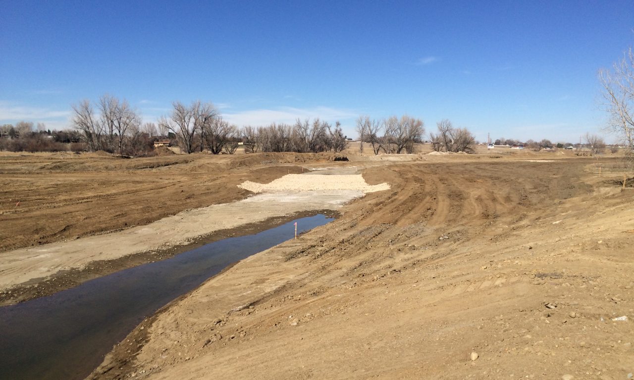
With many starts and stops along the way, the Corps and BCPOS have collaborated over the past decade to move the project forward. Between 2006 and 2011, the Corps, with the assistance of BCPOS, prepared a feasibility study to determine whether restoration of the stream channel, riparian habitat, and other associated aquatic habitats within the project site were technically feasible, environmentally acceptable, and provided cost-effective environmental benefits. In 2011, the project’s feasibility study and environmental assessment were completed. A conceptual natural stream restoration plan was approved and a Project Partnership Agreement was signed by the Corps and the county to move the project forward to the Design and Implementation Phase. In 2014, the project’s design was finalized, and the project’s groundbreaking occurred in October 2015. At the time of this article, the majority of earthwork is complete. Between spring 2016 and winter 2017, over 5,500 native trees and shrubs will be planted and a diverse mix of native grasses, sedges, rushes, forbs, and shrubs will be seeded.
The final stream restoration design includes excavating a new meandering stream channel, approximately 6,300 feet in length, on the south side of the existing channel and a 150-foot wide floodplain bench that is allowed to flood along the new channel. Native riparian plants will be planted or seeded along the channel and floodplain bench, and the uplands will be seeded with a native mix of grasses and forbs.
Flourishing Results On All Fronts
It has been 18 years since the master plan was adopted and 15 years since Parks & Open Space first contacted the Corps of Engineers about the potential to partner on this stream restoration project. Patience and persistence by BCPOS staff and the Corps have paid off, and the Lower Boulder Creek project site will once again be a functional, diverse, and intact ecosystem where our native plants and wildlife will thrive as the creek is allowed to meander, the floodplain is allowed to flood, and the newly planted vegetation becomes established and flourishes. The corridor will provide a mosaic of structurally diverse and biologically rich riparian and in-stream habitats surrounded by restored uplands. With a little bit more time and patience, we will truly see the fruits of our restoration labors.
Primary Benefits of the Restoration Project
- Restoring and protecting regionally scarce and declining riparian habitat by planting high quality riparian habitat and providing a functional stream corridor and floodplain
- Providing important habitat for migratory birds and a diversity of other native wildlife species
- Providing improved in-stream habitat, including riffle-pool sequences, gravel bars, large woody debris, and streamside shading
- Increasing the diversity of native plant species along Lower Boulder Creek through active planting and improved natural regeneration
- Creating connections to adjacent habitats along Lower Boulder Creek and across the larger landscape
- Reducing flood velocities and improving the overall hydraulic function of the stream
- Improving aesthetics of the area