Boulder County Parks & Open Space offers grants for research on county open space lands each year. All proposals are reviewed by a team of resource specialists, and awarded research projects are monitored during their activities on open space.
The following is a summary of a 2020 study conducted by David M. Theobald, PhD. His project focused on permeable landscapes for climate change adaptation in and around Boulder and Jefferson counties.
Introduction
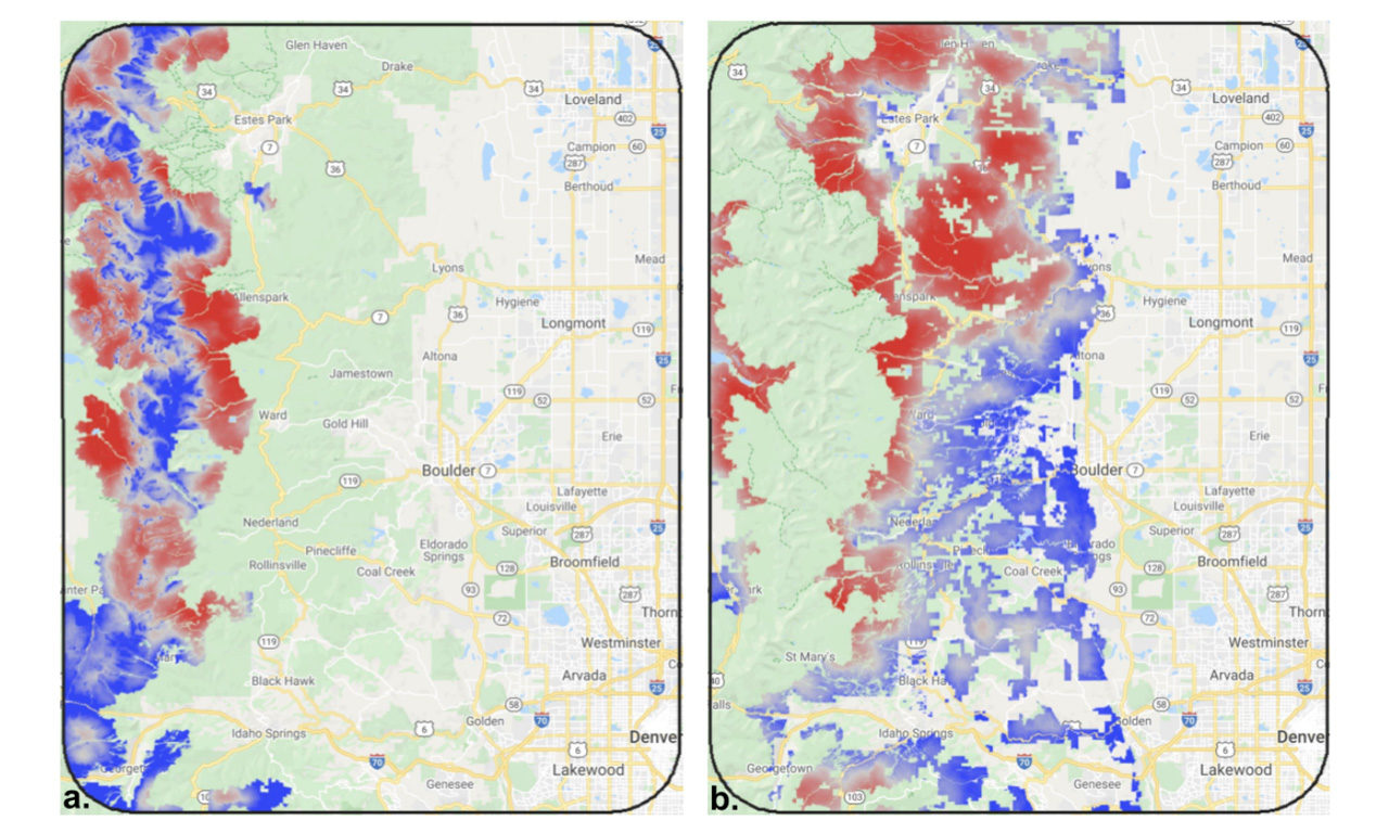
The goal of this proposed research is to inform decision making on open space lands in and adjacent to Boulder County by mapping the landscape permeability and resilience of species, communities, and ecological processes to adapt to climate change impacts. Because a primary strategy to adapt to climate and land use change is to maintain and restore ecological connectivity, then understanding where the critical locations that maintain and restore landscape permeability are located is fundamentally important. This information will inform decision making around resource management, protection priorities, and collaboration with land management partners within and surrounding Boulder County, including Boulder County Parks & Open Space (BCPOS), the City of Boulder Open Space & Mountain Parks (OSMP), and Jefferson County Open Space (JCOS). We will take a coarse-filter conservation approach, in recognition of the relatively high uncertainty about how future ecosystems will evolve with climate change in the next 10-50 years, particularly at detailed scales, and because life history data for specific species is typically limited.
To achieve the goal of this research, the following research objectives will be pursued: (1)identify the study area, specifically the “core” analysis area and surrounding lands; (2) compile spatial data on important habitat locations, protected areas, and intact natural lands; (3) model landscape permeability/connectivity; (4) evaluate the gaps, vulnerabilities, and opportunities for each ecosystem and the full landscape; and (5) provide key results and recommendations for follow-on activities. This work includes all lands within the core study area as well as surrounding lands because understanding connectivity needs to include cross-boundary wildlife movement and ecological flows to and through the complex of parks and open space lands.
This project will contribute to the missions of BCPOS, OSMP, and JCOS because it will inform decision making and evaluate broad conservation strategies and provide a tool (dataset) to evaluate future opportunities and management actions to address potential changes (e.g., increased development, transportation development, increased visitation, potential invasive/disease expansion or outbreaks). This work strongly addresses the priority research topic to advance the ability to adapt to and mitigate effects of climate change on natural systems—specifically to wildlife migration and connectivity issues. The proposed work is well supported by the conservation science literature.
Moreover, this work likely can make important contributions to bridging science and practice as a prototype/case-study of recognizing very large extent with management relevant scale information.
Briefly, key supportive findings from pertinent literature include the following. In conservation planning, maintaining connectivity has been recommended as a primary strategy to adapt to climate change (Heller and Zavaleta 2009). Maps of landscape permeability inform connectivity conservation initiatives at broad scales by identifying locations and their relative importance for maintaining landscape connectivity, protecting the movement of species, retaining landscape-scale ecological processes, and facilitating adaptation to climate change (Theobald et al. 2012). Permeable landscapes are needed to maintain ecological processes, genetic diversity, potential for communities and populations of species to adapt as the climate and land use change (Anderson et al. 2016). Riparian areas are expected to provide critical movement corridors and are among the most threatened habitats in many regions (Krosby et al. 2018). Keeley et al. (2018) found that evaluating structural connectivity for climate change adaptation provides a practical approach as a proxy for movement patterns of a wide range of species and has relatively low uncertainty.


